Showing posts with label trail running. Show all posts

Thursday, August 16, 2018

What's in My Pack for the PCT

As I anxiously watch the air quality index, I figure it's time to get my pack ready in case I decide to go right away on my two-day run southbound on Section J of the PCT. We have had smoke in the Seattle area from forest fires in BC, Canada, and in eastern Washington, and the air quality index was 179 yesterday, classified as "unhealthy for everyone." Yikes. I may decide last minute to go the next day, and I want my pack ready.

Here's what's in my pack:

Note: I changed out #20 for a taller, narrower bottle (same brand). It fits in my front vest pocket better, is still 17 oz., and has a wider mouth so it will be easier to put Perpetuem in it.
1. Montbell down jacket (for sleeping)
2. Ibex Woolies 3 pants (for sleeping)
3. Bug netting sewed to a headband
4. Sleeve Stars ankle compression sleeve (in case I twist an ankle)
5. North Face Better Than Naked tank top (for changing into to wear under my jacket)
6. Ultimate Direction Fastpack 20
7. Z-Packs down hood (for sleeping)
8. Reflectix (sleeping mat with an R-value of 9)
9. My "tivy" (tent-bivy that I sewed myself with Dyneema waterproof, breathable fabric)
10. Titanium tent stakes (3)
11. DHEA, probiotic, 3 mg time-released melatonin, 15 SPF lip balm, duct tape
12. Trail notes (junctions, water stops, maps of junctions)
13. First aid kit, hydration salts
14. Paper towels and baggie (for pottying)
15. Black Diamond Z-Pole
16. Bear spray
17. Petzl e+LITE headlamp
18. GoPro Session 5
19. Spot Gen3 satellite messenger
20. HydraPak Stow Water Bottle 17 oz (for mixing Perpetuem and Tailwind Recovery in)
21. Katadyn BeFree 20 oz water filter/bottle
22. Ultimate Direction 50-oz bladder
23. Hammer Perpetuem, 6 scoops per bag (2 bags plus one also inside #24)
24. Toaks Titanium 450 ml Cup, Evernew Titanium Alcohol Stove w/ 1 oz alcohol, 6 waterproof matches, nylon cord to hang my food in my pack at night, and Perpetuem inside
25. Tailwind Endurance Fuel (2 bags for 40 oz. and one for 32 oz.)
26. Vega Sport Energizer (for morning of day 2)
27. Tailwind Recovery drink (single serving for end of first day)
28. Vegan trail food: Backpacker's Pantry Spaghetti and Sauce, Louisville Vegan Jerky, Good-To-Go Herbed Mushroom Risotto; GSI Outdoors Essential Spoon
29. Z-Packs 30 down bag and waterproof stuff sack

And here's my pack, fully-loaded:

My pack weighs 8 pounds, 13 ounces without water. My goal was to have it under 8 pounds, and originally, it was 7. But adding things like a first aid kit, lip balm, an extra bag of fuel, and a slightly longer sleeping mat all ads up!

Here's what I'll be wearing for the fastpack:


1. Garmin Fenix 5X and Garmin Forerunner 25 (using Fenix for map both days and distance the second day, and the Forerunner for distance part of the first day)
2. Merrill Agility Peak trail shoes
3. Blue Steel Anti-Chafe Cream
4. Feetures cushioned socks
5. Prescription sun glasses
6. Moving Comfort Crossback Sports Bra
7. Moving Comfort underwear
8. Buff hat
9. Halo headband (has a channel to move sweat to the sides, keeping it out of your eyes)
10. Athleta Sunlover UPF Tulip Back Long Sleeve Top
11. R-Gear Recharge Compression Printed 8" Shorts

In the car for when I finish the fastpack, I will also have supplies. It will include
  • Tailwind Recovery drink
  • Water w/ Vega Hydration Electrolytes
  • Sandwich
  • Wipes (to clean up)
  • Change of clothes
  • Teva sandals
  • Best of all, John (my husband)
The countdown is on and I am getting excited!

Tuesday, August 7, 2018

Southbound on the PCT from Snoqualmie Pass

I am in the taper to my fastpack on Section J of the PCT, so I ran a short out and back on the Pacific Crest Trail today. I started at Snoqualmie Pass and headed south, where the trail begins in forest but then quickly relinquishes its shade for an exposed, rocky climb under motionless chair lifts. This was the only sustained climbing for the day, so it was really pretty easy.

Looking back at the ski lifts at the start of the trail
At about a mile, I entered the woods again as the roar of traffic subsided. The trail was lush and verdant, with gentle undulation and constant rocks to keep me paying attention. About two miles in, I came to an old structure--too big to be an outhouse but a similar shape--perched beside a pond. I encountered four northbound thru hikers early in the second mile as well.

In the center is the strange little building with round, metal openings
Around the third mile, I heard the noisy rush of cars from I-90 again, and a view of the west side of the summit presented itself. Soon after, I saw three more thru hikers. After crossing a talus slope, I plunged into deep woods for a mostly perfect path, occasionally interrupted by rocky sections. Then I was back into brush and rocky trail for a while. Eventually, I popped out onto a four-wheel drive road for about a quarter of a mile before grabbing the trail and forest again.

Typical trail with rocks, which look amazingly small in the photo
A nice section of trail ahead with small sections of rocks
The I-90 eastbound approach to the pass far below
Looking back up the trail from the same spot as the view of I-90 in the photo above
Soon, I crossed a dry creek bed and climbed some rocky steps. Around the fourth mile, I startled a large animal about five feet away from me, hidden in the brush. I didn't see it, but it sounded heavy. My guess is an elk or a bear. I don't think bears startle the way this creature did, though. The trail gave way to Ollalie Meadow next, where I saw four more backpackers, one of whom was definitely a thru hiker. The meadow was the prettiest part of the run, green grass with white granite and a view of Silver Mountain.

The rocky steps
I cross a dry stream bed. Shortly after, I spooked a large animal hidden in the brush.
Ollilie Meadow
Shortly after the meadow, I crossed a road where two cars were parked. I think it was the trailhead for Silver Peak or Mt. Catherine. After the road, I ran through a pretty area with shorter trees, likely a clearcut, and then into the tall woods again to reach the five mile turnaround. There was even a tree with a five on it on a small wooden sign.

Looking northbound in the clearcut
My watched chimes in at five miles, and I stop to take a picture looking back. I noticed the sign with a 5 on it on the tree.
I headed back the way I came and sent an Spot OK message. I tried to text John as well, but found I had no coverage. After another mile or so, my phone rang--my friend, Nicole. We chatted for a while and then I checked in with John. He said the Spot was doing a good job of tracking me, which is surprising since I spent a lot of time in the forest.

Once I was back on the road, I noticed that I could see the elevated part of eastbound I-90 where the Wallace Falls Trail crosses under it. I noted the short wooden posts marking the road as the PCT for reassurance.

One of many PCT sign posts
I-90 westbound elevated section in the distance
It seemed I was back in no time, and indeed, it took me less time to run the second five miles. It was an easy run, and a good chance to practice with the now-updated GoPro Hero Session 5 as well as the Spot. I have a better understanding of how the Spot functions in tracking mode and when sending a message. It can take longer than ten minutes to send an OK message, even with a clear view of the sky, and it is impossible to tell if the sending message light is blinking for tracking or an OK message. I determined that I will turn the tracking off when I stop for the night on the PCT fastpack so that I know when the message light stops blinking that my OK message has been sent. (If I leave the tracking on, it will continue to blink as it sends ten-minute tracking messages.) The GoPro was super easy to use. Next time, I'll have to take some videos, too.

It was also good to run a rocky trail to keep my ankles accustomed to the terrain I will face on the fastpack. I have one ten-mile run left, so I may do another PCT run next week.

Friday, August 3, 2018

Cascade Pass to Stehekin

Mornings such as this are to be remembered. I sit here with a view of Lake Chelan, the smoke mostly gone, my body tired but feeling pretty good, and I am surrounded by three people who love me. It's taper time, as I successfully completed my second biggest running event of the summer, Cascade Pass to Stehekin, as well as the always more difficult second long run the day after.

I turn on the Spot at the Cascade Pass Trailhead. John gave his final words of encouragement, and off I went at 5:29 am.
The run from Cascade Pass Trailhead near Marblemount, WA, to Stehekin, WA, was one of the easier trails I've run, and the scenery was majestic. The route began with a gentle and moderately technical 3.5-mile climb to Cascade Pass. I started at 5:30, so the sun was just brushing the peaks with a vivid wash of golden light, the half-moon still visible. As I approached the pass, the forest surrendered to an alpine landscape of purple heather and granite rock, the saddle swathed in light, shifting fog.

The approach to the pass is my favorite part! The heather was in bloom amongst the granite, and a light fog hovered on the pass.
I had the pass to myself, and paused briefly to take a photo before beginning the rocky descent on the eastern side. As I crisscrossed the mountain side north to south in short switchbacks punctuated with wildflowers, I noted the rush of wind or water each time I turned a northern reach. On the final switchback, the water made itself surely known, both in volume but finally in sight. To my delight, I had reached Doubtful Creek, for which there is no bridge.

The fog is mostly clear once I get to the pass, so I could see into the valley. 

Finally I see the source of the sound--Doubtful Creek. Because of the sun, it is hard to see the creek in this photo.
The slope there was steep, so my way across was simply one level in a many-tiered waterfall. Huge granite boulders created a pool less than a foot deep. I removed my shoes and socks, tied them together, and looped my vest strap through the laces so I wouldn't lose them. The water was refreshing and not too swift. John's reminder to face upstream came to mind as I waded across maybe four feet to where the boulder protruded from the water. I sat on the warm granite in the sunshine to take a few pictures with the Hero Session 5, and then worked my way around a second, deeper pool.

The waterfall at Doubtful Creek
Soon after, I encountered two backpackers heading up to the pass, likely getting an early start to beat the heat. Next came the junction with Horseshoe Basin where I turned right and continued descending. At this moment, I recalled that there are grizzly bears in the North Cascades, and wondered why that didn't freak me out! I entered a brushy area that soon opened up to a charming, bouncy bridge across Basin Creek. From here, I ran in and out of the brush and dry stream beds, picking my way carefully through the rocks. I talked out loud to myself to let any bears or other predatory creatures know of my presence.

The junction with Horseshoe Basin, which is straight ahead. My trail went down behind me.

My route down from the Horseshoe Basin junction.

The bouncy little bridge at Basin Creek

Around mile nine, I entered a tall forest and encountered Cottonwood Camp and bear scat (not fresh). The trail followed an old road bed for the next seven miles with a gently descending grade and fir needle-cushioned tread. It was easy running and it was fun to watch my average speed rise from 3.4 miles per hour to 3.7. I continued to run through brush, huckleberry, and forest, most of the time unable to see much, occasionally encountering a rocky streambed. I noted the berries on the bushes and resumed speaking my unprofound thoughts--"There's some Indian Paintbrush, there's some more granite rocks, stay focused, 'mind in boat.'" I talked to John, imagining that he was likely in Winthrop by now having coffee. I talked to my dad, too, asking him to keep watch over me.

The trail widens when it reaches what used to be the Old Stehekin Valley Road. The river was particularly pretty here, as it shoots through a narrow granite wall canyon.
All the while, the rush of the Stehekin River was by my side to the south, a constant comfort that there was water nearby if I needed it. I refilled my bladder after crossing a solid bridge at the aptly-named Bridge Creek. Eventually, I reached the junction with the Pacific Crest Trail and left the old road bed. After going downhill for most of 12 miles, it was nice to head uphill, and the return to real trail was not too punishing. Having not seen anyone for four hours, here I saw a group of eight or so backpackers, the last of whom advised me that the previous hiker they had passed had seen a bear at the upcoming creek. I heeded his warning by talking out loud to myself yet again.

This part of the route was entirely in forest, and I found myself in a grove of huge, ancient cedars. When I came to the junction where I could continue trail for another mile and a half, or take a short trail to the Stehekin Valley Road and High Bridge, I chose the latter since the tendon on the side of my left ankle was giving me a little trouble.

I was glad to have made the choice, since the river crossing at High Bridge was beautiful. I tried to take a picture but the GoPro was refusing to take pictures (and had been for quite some time). I believe it needs an update, as we have never done so since buying it last year. The last 13 and a half miles were on the road, which changed from gravel to pavement and back again numerous times. It seemed to go on forever. The ever-present river made a nice water stop. The day was getting hot, and shade less frequent, so the wind picking up was a welcomed treat. I knew it also meant that the boat ride from Chelan to Stehekin was rough and unpleasant for John, Dana, and Jill.

Eventually, I passed the orchard and the school house, and finally encountered the bakery where the red shuttle bus was stopped to let eager tourists make pastry purchases. I asked the driver how much farther to Stehekin, and she said two miles and asked if I was doing OK. I made up my mind to run the final two miles to Stehekin, as I was taking walk breaks at this point. I diligently stayed hydrated and while it was quite hot (90+ F), I felt pretty good. I was so happy to see the lake on my watch map--I saw it there before I actually saw the lake. Soon after, I saw Purple Point, my rendezvous with John, Dana, and Jill. I also noted the whitecaps on the lake and doubted that they had arrived yet. For one thing, I was half an hour early! I finished at nearly 1:30, just under eight hours. My speed averaged out to 4.1 miles per hour over the course of 32.85 miles.

I made my way to the bathroom where I changed out of my sweaty clothes into a bathing suit. I was reluctant to go into the cold water, not wanting to cause a heart attack. Truly, people lost in the desert have been rescued, only to die of a heart attack when someone hands them a cold bottle of water. The body can't take the shock. Instead, I dangled my feet in the water for a few minutes at a time and had my Tailwind recovery drink.

I was wary of getting chilled despite the heat, so I left the windy dock and went to the store and bought a Pelligrino and waited for the boat from my perch on the deck in front of the restaurant. I watched a large crowd board The Lady of the Lake, which pulled away at 2:00, heading for Chelan. At 2:20, I saw a boat approach (there was very little boat traffic due to the windy conditions), counted three people in the boat, and then saw Jill's signature coral outfit. I knew it was them and spread my arms wide as I walked across the parking lot to the docks. Because of the wind, they had trouble approaching. A man nearby saw what was happening and came over to help so I could hop in the boat. We thanked him, reversed the boat, and headed back for Chelan, 56 miles away.

Happy to be on the boat! 
Jill immediately presented me with grapes, nectarines, and apricots, and then a beer. I was so happy to be on the boat! We began the rough ride back. I was surprised to find that I was hot, even with the boat moving. (When we visited last year, it was cold enough on the boat to wear a sweatshirt and to cover my legs with a towel, and I hadn't been running all day.) The lake was littered with logs and branches and we hit one. The boat immediately lost power; the engine vibrated and sounded terrible. My stomach sunk, as I knew they would never have been out in these conditions had they not had to pick me up. We were still many miles from home with no one in sight. Dana decided to try limping back, which would take until dark. Suddenly, it seemed we hit another log, and two bumped along in our wake and the boat was abruptly normal. We think that the log was actually stuck somehow under or behind the boat, and when he bumped the second log, it dislodged. The boat was not harmed at all, thank goodness!

We capped the day with a fantastic Beyond Burger with lots of fresh toppings. It was so, so good! We all went to bed early, around 9:20.

The next morning, John and I got up at 6:00. I still had one more training run to complete. I planned to do 20 miles, heading up the hills that surround Lake Chelan. There is a dirt road the goes up steeply right behind Dana and Jill's house. John and I hiked together up it for three and a half miles, and then I continued on my own and began running. I ran out of road at seven miles, so I had to head back down, knowing I would have to complete my run on the paved road. Despite this, I was frankly relieved because the smoke was getting thick up there--there were two wildfires in the area at Entiat and Winthrop--and I was getting anxious about getting overtaken by fire.

John and I hike up the dirt road together for about three and a half miles. I continued running and he went back down the road.
Going back down the dirt road, it was quite steep the last two miles. I had to walk because my quads were so sore and simply spent. I wanted to cry, but then I told myself (out loud) to toughen up, Ellen! So I laughed at myself and kept going. Once back on the pavement, I had John meet me with some water, as I was almost out. The air was clearer down below, but the road has no shade and my legs were shot. I made a deal with myself that if I ran without any walk breaks for the next two and a half miles, that I could turn around and walk back to the house, topping out at 18.5 miles. I could have walked an additional mile and a half, but 18.5 put me at 71.5 miles for the week, significant because I have to do 71.3 on the PCT. I figured that was enough, and everyone was waiting for me so we could go to town and get coffee.

I was so happy to be done! John met me out at the top of the driveway.
The rest of the day, I hobbled around and enjoyed myself. We wine tasted, had lunch at Karma (vineyards and bistro), and then dinner at Sorento's. Though we only had a few vegan options, our meals were delicious! I had a green hummus, made from fresh-picked garbanzo beans and a flatbread with marinara and vegetables for lunch, and then pasta with artichokes, roasted mushrooms and tomatoes, olives, white wine and herbs for dinner. We had brownies and blueberry pie that I'd made at home for dessert! I woke up this morning feeling great with just a little residual soreness in my quads. I am taking a rest day, as Jill and John are hiking with Jill's friend Linda and Dana is walking to the store to get his blood flowing. I am looking forward to a day relaxing on the lake!

We get ready for a late dinner at a winery! The sun was red because of the smoke from the forest fires.
It feels wonderful to have accomplished my goal! I would love to hear what goals you have, and I am happy to lend any advice if I can. I know that my fastpack on Section J of the PCT is going to be the hardest thing I have ever done in my life, so I also welcome any encouragement or advice you may have!

Sunday, June 17, 2018

Running Up Mountains: Lessons Learned

As my watched beeped for mile seven of my eight-mile run today, I smiled and thought about how that was mile 50 for the week. Elite runners boast of averaging 50 miles a week for an entire year, but for me, 51.5 miles for the week without injury is an accomplishment! Later my husband reminded me that I have to run that all in one day on my first day of the PCT Section J fastpack I have planned for late August. Uh huh. It's going to be a long day with lots of hiking up steep sections.

Speaking of HIKING up steep sections, yesterday, I ran the Issaquah Alps westbound, adding a two-mile section of the Coal Creek Trail to get to 24 miles. I finished the toughest part of the run, Tiger Mountain, feeling pretty good and began the climb up Squak on the East Ridge Trail, a never-ending Z of switchbacks. Normally, I hike more than half of this, but yesterday, I realized I was running it and feeling good. I thought, wow, am I actually going to run this thing? I thought I was nearly at the top, so I kept running. But as many a hiker knows, one switchback can look like the next, and the next, and the next. I should have walked at that point, but I just kept going, wanting to run the whole thing. Mistake.

On my way down Squak on Margaret's Way, I was really, really tired. I repeated the mantra, "Mind in boat" (if you've read Boys in the Boat you know what I am talking about), and stayed as focused as possible so I wouldn't stumble. My hamstring can't take another lunge forward. As I approached a tangled mass of roots, I tripped first with my left foot and then my right. I just couldn't pick my feet up enough to clear the roots--I was that tired. I didn't hurt my hamstring, though, because I pitched forward Superman-style and landed in a plank position. Even my core was tired, I noted, as I pushed awkwardly up from a pushup position. And I still had Cougar Mountain to go.

Amazingly, Cougar afforded me some nice hiking breaks and I was able to run down the west side, however slowly. Then came the section that was new to me on Coal Creek. Thank goodness it was groomed and wide, with mostly a gentle downward slope. I simply had nothing left. My run turned out to be 25.5 miles, clocking in at seven hours, 45 minutes. The previous long run of 23.5 took me 7:36, so I was pleased with my time but not with how I felt. I have never wanted to be done so badly, even in 50Ks. I should have hiked more of the East Ridge Trail.

I subscribe to the motto, "Just because you can doesn't mean you should" in many aspects of my life. Looks like I need to apply it to trail running.

I was lucky that the sun was blocked by high clouds until about 1:00 pm. It kept me cool for most of my run.

Saturday, February 17, 2018

Revised Fastpacking Training Schedule

As I've be running on the trails again and realizing how much I need to toughen up my ankles and quads, I've given some thought to following a 50-mile training plan instead of a 50K training plan. Since I will be running 50 miles the first day of my fastpack, and then 20 the second day, I think it's a good idea. The main difference is that instead of alternating an easy week with a hard week, I'll have two hard weeks in a row, followed by an easy week. This idea comes from the UltraLadies 50-mile Training Plan.

I am currently running on trails on Wednesday and Saturdays. I intend to run on trails on Sundays when I can, but by June, I want to be running trails consistently on Sundays, too. Also in June, I hope to start running parts of the PCT for my weekend runs, whether easy or hard. The more of the terrain and elevation I can get, the better. Of course, in June snow may be in issue in the higher elevations, but as soon as I can start training at 5,000 feet plus the better!

Here's the plan:

Saturday, February 3, 2018

Hitting the Trails

February is going to be the month of getting my body acclimated to trails. I didn't realize it until this morning that I haven't been running on trails for two years. I've been working in one trail run a week over the month of January mostly in Redmond Ridge and Watershed or Moss Lake. Both of these locations are non technical with moderate hills. On a scale of 1-10, I rate them a 0 for technicality, a 0 for elevation, and a 2 for elevation gain.

Wednesday, I decided to try something a little more challenging and ran seven miles up the High School Trail and on the Lake Tradition plateau (at the base of Tiger Mountain). It was a rude awakening! I got bounced all over the trail and my feet and ankles were really tired. I rate this a 5 for technicality, a 0 for elevation, and a 3 for elevation gain.

I've reached the top of the High School Trail, a one-mile, rocky jaunt the climbs to the Lake Tradition Plateau from behind Issaquah High School.
In my training I alternate between easy and hard weeks. Last Saturday was a hard week and I ran 16 miles in Redmond Ridge and Watershed. It was easy and I had a great six-mile run on Sunday through the neighborhood, averaging under 10-minute miles, which was good for me on a route with hills.

The Redmond Watershed delights with a beautiful forest and spongy trails!
Bolstered by last weekend, I decided to do my "easier weekend" long run in Grand Ridge; it was an even ruder awakening! I set a goal of running 12 miles in two and a half hours. I took the Grand Ridge Trail up and continued over the road to what I call the New Trail on the Duthie side. I had to go a little farther down after that to get to six miles for a turn around point. The climb wasn't too bad and I took it slow. What was shocking was any small hill after that felt so hard. It felt like I was running at elevation. At six miles I decided to use a Clif gel. What a difference. The climb back up felt fine. Going back down the Grand Ridge Trail I felt a little lighter but my pelvic floor was weary and my feet were tired. I clocked in at 2:24:42. For technicality, I give this a 5, for elevation a 0, and elevation gain a 5.

I'm to the last part of the Grand Ridge Trail's climb--yeah!

It's going to take a while before 12 miles in Grand Ridge feels easy liked it did a couple of years ago. Hopefully, that time will come on March, when I officially start my training with 20-mile Saturdays and building from there.

-LTR

Sunday, December 31, 2017

Fastpack Gear

One of the funnest parts about planning for the fastpack, besides the training, is figuring out what gear I am going to use. My goal is to have my pack be under seven pounds without water. I have to consider the following:

  • Running pack/vest
  • Food
  • Water vs. water filter, hydration pack
  • Clothes to sleep in
  • Sleeping bag
  • Tent or bivy
  • Sleeping mat
  • Headlamp
  • Spot/emergency contact

For the pack, I was hoping to go with a women's specific running vest, but I wasn't sure if there would be enough room. I love my UltraVesta from Ultimate Direction, so I ordered the Aventure Vesta, also a women's specific running vest. It didn't look like it was going to have room for the gear, so I also ordered a 20L fastpack from Ultimate Direction, which was on clearance at the time for only $79.95. You can only get the 15 or 25L Fastpack now (https://ultimatedirection.com/fastpack-25/). I didn't get any perks for suggesting Ultimate Direction or any other brand I mention. I just like their running packs because they don't move at all, are well designed, and fit well.

The two packs arrived, but before I could decide which one I was going to keep, I had to order the rest of the things I was going to pack. I ordered three freeze dried meals, a collapsible water bottle with a built in filter, Ibex Woolies 3 pants and hoodie, two different options for a sleeping mat, and an ultra light sleeping bag. Once I had assembled all my gear, I tried out the two different packs; I sent the Aventure Vesta back. It turns out that, though light, most of my gear is really fluffy! The 20L Fastpack weighs in at 18 oz.


For the freeze dried food, I ordered three different vegan meals. Since I don't want to carry a stove or fuel, my plan is to hydrate the food with cold water. I think if I let it soak long enough, it will be edible. I don't care about having hot food. I plan to test out each of the three meals and see which one hydrates the best. I will probably pack two of them on the actual fastpack. Two food packages weigh 8 oz. total.

Normally, I use a lot of energy gels, but they are actually relatively heavy, so I am only planning to pack two caffeinated. My favorite is Accel Gel and Second Surge, both made by Pacific Health Labs, because they taste good and have protein, but since becoming a vegan, I have been trying out new ones. So far, I am happy with Clif gels, but they don't have protein. I have tried Luma, which basically tastes like jam. They are made from chia seeds. I get protein from them, but they seem to give me heartburn. I will probably resort to Hammer Perpetuem designed for all-day endurance as a liquid meal. Two gels weigh 2 5/8 oz, and six Perpetuem servings (one in a mixing bottle) weigh 4 5/8 oz. I'll also need five servings of Vega electrolytes, which are 1 oz. total.


I am going to need to refill my water bottle and bladder several times on the fastpack. I have a LifeStraw, but I couldn't figure out a way to use that with the bladder. Instead, I decided on Katadyn Be Free Water Filtration System, which I ordered from Amazon. I plan to fill it at a stream, and then squirt the contents into my bladder. The 50 liter bladder I'll use is also from Ultimate Direction. I've had a 70 liter one for years, and it has never leaked. I will only put 30 oz in the bladder to start. Water weight is just too heavy and I can always refill. Empty, the bottle and bladder weigh 4 oz.

Ibex Woolies 3 was my hands-down choice for night-time clothing. Sadly, Ibex just closed shop, so getting their clothes in the future will be next to impossible. Most of the gear is merino wool. but their Woolies 3 is a wool blend. I used it at Cascade Pass this fall, when I had run up, sweated my shirt wet, and then had lunch; resting combined with wind makes for a chilly recipe, but my Woolies 3 cut the wind beautifully. I got the pants (not running tights) and a hoodie. They weigh 18 oz. total.

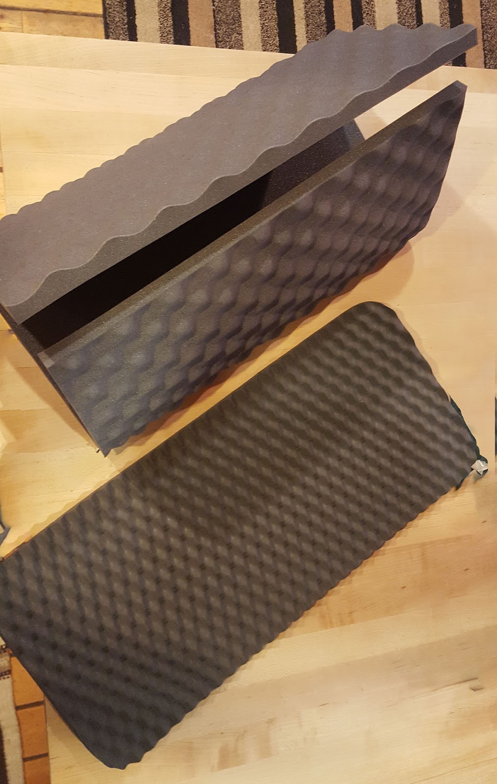
I already had a Thermarest for backpacking, but it's just too heavy at 10.5 oz. I scoured other blogs and internet articles and settled on Gossamer Gear, a closed foam option. I still haven't decided on whether I'll take the mat or the sitting pad. The SitLight Camp Seat, weighing in at 2 3/8 oz, is a little bit short, and the Nighlight Sleeping Pad at 6 oz is too big for my pack even trifolded. I will probably have to use the sitting pad.


For the sleeping bag, I went with a ZPacks classic sleeping bag, rated for 35 degrees. They're not cheap, but they are warm, pack down small, and are incredibly light. They come with a waterproof stuff sack.The bag is 14.6 oz. I also decided to make a bivy/makeshift tent of my own from ZPacks material. I will follow up later with a detailed post when I actually make it.The weight should be 4 oz.

I'll also have to pack my headlamp (1 oz.) and I plan to buy a new Spot Satellite Messenger (4 oz. with lithium batteries). I think I am also bringing one titanium running pole at 4 7/8 oz.

The tiny Petzl E-lite has a whistle on the head strap and a carrying case. Ill leave the case behind.


Everything sounds really light, but it all adds up! Right now, I am under 5 pounds without the pole and without water.

Friday, December 29, 2017

Fastpacking Dreams

I am a self-proclaimed recovering trail runner.

I decided to start this blog as I prepare for a fastpacking goal I've set for August 2018. My hope is to help other runners like me, who maybe aren't up with the elite runners in any given race, but still have aspirations to improve, to challenge themselves, and to accomplish feats they never thought possible.

The road, or should I say trail, to this journey began ten years ago. I had started running again after taking a few years off, and to inspire me, my husband signed us and three friends up for the Mountains to Sound Relay. I was hooked from then on, carrot and stick--I loved having a goal to work toward. My 10K portion of the relay led to several 10K races, which eventually lead to a half marathon in Missoula, MT, which then led to several marathons. A hamstring injury and thwarted Boston attempt led to trail running and eight 50Ks. I was pleased with the level of athleticism I had achieved, but dialed back to find better balance in my life.

Training for 50Ks takes a lot of time, especially since most of it takes place on trails. My last season racing, which was September to December of 2015, I had built up the most endurance I'd ever had, training for The Oyster Dome Challenge. Only a 50K (which is the most I've ever done), it had 9,400 feet of elevation gain. It took me over eight hours, the longest time I've ever run, but by the end of the race, I felt like I could keep going. I've never felt that before at the end of an ultra marathon. I ran one more race in California in December, and then I reduced my long runs to 10-12 miles.

But there was one niggling ember waiting for me to breathe life into it. Before I started running half and full marathons, I ran 13 miles of the PCT (Pacific Crest Trail) to meet some friends who were coming from a point farther south. Completely alone, I started off at 6:00 a.m. and ran my way to the the sunrise over the Cascades. When I reached a ridge top, I couldn't believe the breadth and solitude of the moment, and I have held the image in my mind as a reminder of strength, vitality and beauty. When I reached the meeting point, I rested in the sun, napped even, and waited for my friends. We hiked 13 miles back, and my friends were so proud of me. I was, too. I didn't know then that I had kindled a love of trail running and sparked a goal to be.

A few years later, my husband encouraged me to run up to The Catwalk from Snoqualmie Pass, also on the PCT. It was about six or seven miles up, at times challenging due to elevation or scree, but incredibly scenic. It rained lightly on me, but I didn't mind the briskness of the August day, and hoped to come back again. Soon after that, my husband and I discussed me running from Stevens Pass to Snoqualmie Pass on the PCT. In all, it's about 78 miles, depending on what source you consult. I decided that I would like to try fastpacking it--that is, running all day with a very light pack, camping out, and then running all the next day. But I hung up my trail shoes before I could even think about accomplishing this.

Since my last trail race in December 2015, I tore my plantar fascia and had surgery, and my beloved dog died, leaving my husband and me childless, so to speak. The 78-mile journey was an ever-distant goal. Besides the occasional trail run at Lake Tradition, I really hadn't been doing anything other than running on dirt roads in my neighborhood. Because our dog was my husband's hiking companion, and when I say companion, I mean hiking soulmate, we have been reluctant to hike this past summer and fall. We did finally make it out to Cascade Pass, with my husband hiking and me running. I ended up putting in a 20-mile day. I was sore and exhausted, but also elated.

I pause just before Cascade Pass to photograph the snow that turned the last part of my run into a hike.


That day, as we headed back down from the Sahalee Arm to Cascade Pass after having lunch, my husband pointed out the trail that leads to Stehekin. This led to a discussion of me running from the Cascade Pass Trailhead to Stehekin, where he would meet me with some friends who have a home--and a very nice boat--on Lake Chelan. I researched the distance and found it would be 34 miles. The PCT fastpack also came up, and with his encouragement, I have decided to go for both.

I have been gradually acquiring gear for the fastpack, and have planned out a training sequence, both for the Stehekin route as well as the PCT. I am now "training to train" as I like to call it.

Training for a 75-mile Fastpack in Retrospect

I've had considerable time to process my training for and run on Section J of the PCT this past August. My return to a normal running sc...