I set out at 5:30 this morning on the PCT from Snoqualmie Pass to do 30 miles, out and back. My goal, besides training, was to see all but six miles of what I will have to do the second day of my PCT Section J Southbound fastpack in exactly four weeks from today. In addition to the terrain and elevation gain/loss, I learned a lot about water and my gear. It was a good experience, rounded out by meeting some southbound through hikers.
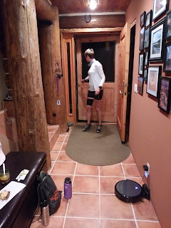 |
| I got up at 4:00 to eat breakfast and pack up. I had prepared everything the night before, so it was fairly quick. I was out the door by 4:30. Note the darkness outside the screen door! |
I found the run up to the Kendall Katwalk to be fairly easy in terms of the grade, but a bit rocky. I had to be careful of my footing after the first half mile the entire day. There was lots and lots of granite throughout the 15 miles of trail, the mostly sharp and pokey kind that seems to grab your feet, along with some basalt (I think). After the Katwalk, I climbed another thousand feet to reach right around 6,000. It wasn't too bad in terms of feeling the elevation, but the trail was super rocky after the Katwalk, with nearly three miles of talus slopes/scree with little in the way of runnable trail. It was slow going. My average of 3.0 miles per hour dropped to 2.9, then 2.8, and then 2.7 when I stopped to fill up on water just after turning around.
 |
| Throughout the day, I had views of Mt. Rainier. It looks tiny in the photo due to the camera, but the mountain loomed impressively on the horizon all day. You can see my bug set up on my hat, too! |
 |
| I reached the Kendall Katwalk just before 7:30. It was lovely to have it all to myself n the soft morning light. |
 |
| I really enjoyed the view of Joe Lake (lower left). After cresting a ridge, I dropped down toward it (but never to it) and eventually ended up on the other side, climbing up again and then going beyond it. It was my favorite lake view of the day. |
I found the terrain, not the elevation, to be challenging, more so than I had hoped. It took me half and hour longer than my long end of the time estimate I gave John when I left. I am still concerned about being able to do 50 miles before dark on the first day of the PCT fastpack. On the bright side, I did get better at crossing scree, seeing some of it as "big gravel." I also learned to use my pole in a new way. I developed a sort of run/walk rhythm with the single pole: I would leave the pole firmly planted for two swings of my other arm instead of lifting it for each alternating arm swing. While the pole was down, I would run left right left and then walk for the final right, plant the pole again, run left right left, walk right, and so on. It served me well in crossing rocky or steep terrain, whether it was up or downhill.
 |
| I was pretty impressed that I crossed the talus slopes, so I looked back to take a picture. The red line marks the trail. However, I didn't know that I had another solid mile and a half of scree coming up! What I had crossed so far paled in comparison because it was broken up with short sections of nearly runnable trail. |
 |
| This is a sampling of what I had in store for me still. Large rocks, un-runnable without a break for a mile and a half. I wrenched my ankle and jarred them plenty of times. In this photo, Mt. Baker is in the middle on the horizon. It was my only view of Mt. Baker that I noticed. |
The most interesting thing that happened today had to do with my water supply. I noticed early on that I was really sweating at the small of my back. My shirt was wet and clammy. It's the first time I had worn the shirt, so I blamed the shirt. It even wicked onto my pack. Hmmm. The thought crossed my mind that maybe my bladder, which has NEVER leaked, was somehow leaking. But I dismissed that thought since the Ultimate Direction bladders are so good.
At mile 13.35, there was a great stream, so on the way back I decided to stop and refill my bladder. To my surprise, the bladder was open! I had started the day with the bladder in the outside sleeve of my vestpack for easy access, but I found it moved around too much, so I moved it to where I usually have it, the inner sleeve made just for it. I don't know if I somehow slid the closing mechanism off then, just enough to cause problems down the line. But what I think happened is that it gradually worked its way off the top of the bladder. The closing mechanism has an loop to run a strip of velcro through so it can be held in an upright position. With the mechanism being slightly off and then all the jostling around as I ran, I think it just slid off. I had very little left in my bladder. I would say about half of it had leaked out. No big deal because I had my Katadyn soft bottle with a filter built into the cap.
This brings me to lesson number five: don't let the harassment of bugs get to you! The bugs were particularly bad at this stream, and in my rush to get the water and move along, I did something really stupid, the kind of stupid that's embarrassing to admit. I was supposed to fill the Katadyn bottle, put the cap with built in filter on, and squirt it into my bladder. But what did I do? I just dumped the water from my Katadyn bottle right into my bladder! At least I realized it before I drank the water. I dumped everything out of my bladder and had to settle for the .6 liter Katadyn. Fortunately, there was water again around mile 9, and again at 7, and yet again at 3.25 (miles from the car). I was never thirsty today.
I also brought an extra food item, which may sound trivial (a Clif Bar) but I never depleted my glycogen stores today, evidenced by the fact that my legs never got shaky. Now I know I did a lot of hiking because of the rockiness, but I covered 30 miles and had 9970 feet of elevation gain and loss. My conclusion about future long runs is that I need to hydrate better and eat more instead of relying on gels, Perpetuem, and Tailwind.
One small thing to correct is my hat and bug netting set up. I sewed bug netting to the inside rim of my hat and put a tiny piece of velcro on the top so I could put it up out my face as needed. It worked quite well, but as long as I was moving, I didn't really need it. What I did need was something to block the sun from the back of my neck. I think I am going to take the netting off my hat and sew it to a small headband instead so I can put it on over my hat as needed, but then sew some kind of UV blocking material to the back of my hat to shield my neck. I know I can buy a hat like this, but I really love my Buff hat. I can hardly tell I have it on!
The highlight of my day, besides the incredible views, was meeting two incredible people, Susanna and Jen! They are solo southbound through hikers from California. I saw both of then (separately) in the first half of my day. I chatted with Susanna in the rocky switchbacks when she got her first view of Mount Rainier. She is quite the backpacker; she did section J in just three days! When I saw her in the last two miles of the day, I was beginning to think I would never catch her. And then when I saw Jen again right at the very end, I was surprised to learn that she, too, was through-hiking, and she had just completed 17 miles. They both looked so fresh. I thought Jen was just out for a casual backpack. I was very impressed, not only with their stamina, but that they were both hiking alone. We all ended up at the parking lot at Snoqualmie Pass at the same time, so I gave them a ride to the other side of the freeway to the Summit Inn, where Jen was staying (and probably Susanna, too, since the food truck and camping in its parking lot didn't manifest).
Sad note for the brother and sister through hikers from Buffalo, NY. They started their through hike by doing the California section, and then flip flopped to the Canadian border to work their way to the southern Oregon border. Today, they hit the 1000 mile mark! The sister was talking about a buffet at Snoqualmie Pass that she was looking forward to. I don't really know what's at the pass, but later it occured to me that she said something about a casino.... I wish I had realized it then, but Snoqualmie Pass and the Snoqualmie Casino are NOT in the same place.
 |
| I returned at 5:30 after a long day. I felt the best I have ever felt after a long training run. |


